|
|
The History of
Sabino Canyon
(This timeline is not drawn to scale.) |
|
12 million
BC |
5 million BC |
6,000 BC |
2,000 |
300 -1400 AD |
1854 | 1887 | 1905 | 1930s | 1978 |
| _______________ | ______________ | __________ | _________ | _________ | ________ | ______ | _______ | _______ | _________ |
| Santa Catalina Mountains begin to form |
Mountain Range and Tucson Basin form (end of mountain movement) |
First Saguaros in Sabino Canyon |
First Paloverde Trees in Sabino Canyon |
Hohokam People live in Sabino Canyon |
Sabino Canyon becomes part of U.S. |
Big Earth- quake in Mexico |
Forest |
Roads, dams, bridges,
and picnic tables built in Sabino Canyon |
First Shuttlebus
Service - cars eventually banned |
|
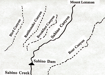
Sabino Canyon is located in the Santa Catalina Mountains in the Coronado National Forest.The canyon is located just outside the city limits of Tucson, Arizona. The Coronado National Forest is in the Sonoran Desert. The Santa Catalina Mountains began forming 12 million years ago. The movement of the mountains created the mountain peaks as well as the basin, or bowl-shaped land, on which the city of Tucson is built. This movement of the mountain range stopped about 5 million years ago. The land formation is called Basin and Range. 8,000 years ago the first saguaros began growing in canyon; about 4,000 years ago the first paloverde trees took root in the canyon. There is evidence in pieces of pottery, or shards, and pit house foundations that the Hohokam people lived in the canyon between 300 and about 1400 AD. With the Gadsden Purchase in 1854, Sabino Canyon became part of the United States. In Tucson's early days, people took picnics to Sabino Canyon. In 1887, there was a big earthquake in Mexico, 150 miles away from Sabino Canyon. Many of the huge boulders you see in the canyon fell from the canyon walls or were moved in that quake. In 1890, the Forest Preservation Act was passed by the United States Congress and in 1905 when the Forest Service was created, Sabino Canyon came under its supervision.
The area is managed by the Forest
Service. Their jobs include maintaining the canyon as a recreation
area and learning center, protecting the creek, soil,and wildlife,
and managing the relationship between Tucson and the canyon, including
controlling fires and floods. Sabino Canyon
is a treasure for Tucson residents and tourists alike.
|
| What are some things you can do to help protect and show respect for Sabino Canyon? |
|
© 2001-2017 Judi Moreillon |


